Project Description
This project aims to characterize the hydrology-driven landslide hazards in the northwestern US through quantifying the extent and severity of active landslides and identifying landslide triggering mechanisms by analyzing landslide motion, precipitation, soil moisture, topographic information, and dynamics simulation models. We will first pinpoint landslides that have occurred over the northwestern US (Oregon, Washington, northern California) throughout recent years, delineate the extent of the active landslides, and obtain their temporal progress. We will infer the landslide basal geometry and volume and collect all available hydrodynamics-related products (soil moisture, precipitation) measured from the spaceborne sensors, validated with in situ measurements.
The inter-relationship between the onset and progress of the landslides, the hydrologic forces, and topographical and geological settings will be scrutinized to identify the crucial parameters that control the landslide events and dynamics. All of the parameters will be included into state-of-art landslide dynamics models for numerically simulating the landslide motions and flow path and identifying the critical parameters among landslide triggers. All our efforts will bring the fragmented observations and measurements (deformation, precipitation, soil moisture, and rock properties) from ground and space to a single landslide modeling framework, and the incorporated platform will help us have a more complete knowledge on the current and past landslides in the northwestern US.
Project Lead
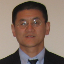
 Zhong Lu, PhD, Professor and Shuler-Foscue Chair, Southern Methodist University
Zhong Lu received the B.S. and M.S. degrees from Peking University, Beijing, China, in 1989 and 1992, and his Ph.D. from the University of Alaska Fairbanks, Fairbanks, Alaska in 1996. He was a physical scientist with US Geological Survey during 1997-2013, and is now a professor and endowed Shuler-Foscue chair at Roy M. Huffington Department of Earth Sciences, Southern Methodist University, Dallas, Texas, USA (www.smu.edu/dedman/lu). His research interests include technique developments of interferometric synthetic aperture radar (InSAR) processing and their applications to the study of natural and human-induced geohazards. He has produced more than 230 peer-reviewed journal articles and book chapters focused on InSAR techniques and applications, and a book on “InSAR Imaging of Aleutian Volcanoes: Monitoring a Volcanic Arc from Space” with Dan Dzurisin. He is a member of NASA-ISRO SAR (NISAR) Science Team (2012 - present), Editor-in-Chief of journal GeoHazards and Associate Editor of journal Remote Sensing.
Additional Collaborators
David L George, PhD, Research Mathematician, U.S. Geological Survey
Jinwoo Kim, PhD, Research Scientist, Southern Methodist University